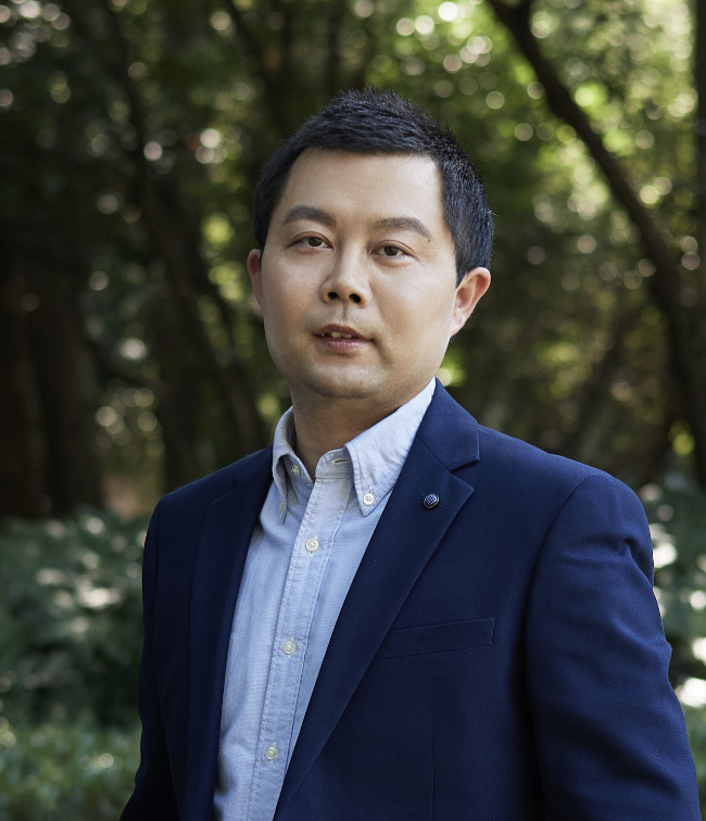
周亚男
副教授,硕士生导师
南京市江宁区佛城西路8号
zhouyn@hhu.edu.cn
周亚男,副教授,硕士生导师。2005.9-2009.6就读于武汉大学测绘学院获学士学位、2009.9-2014.6就读于中国科学院遥感与数字地球研究所获博士学位。现在河海大学地理信息科学系工作。研究领域:地理信息科学,研究方向:基于深度学习的遥感信息提取、时序数据的农业遥感。近年来主持多项科研项目,在国内外权威刊物已发表学术论文近40篇(第一作者/通讯作者SCI期刊论文近20篇),授权或受理的专利5项。2018年获江苏省青年地理信息与遥感科技奖,2019年入选河海大学“大禹学者”第四层次培养对象,多次获得青年教学竞赛奖项。担任JRS,IEEE JSTARS、TGRS,RSE,ISPRS,武汉大学学报和地球信息科学学报等国内外期刊审稿人。
招生信息
以培养具有深厚GIS基础和坚实应用能力的研究生为目标,利用深度学习技术实现遥感与GIS相结合的时空数据分析与应用。欢迎对地理信息与遥感感兴趣的同学报考。
招生信息
以培养具有深厚GIS基础和坚实应用能力的研究生为目标,利用深度学习技术实现遥感与GIS相结合的时空数据分析与应用。欢迎对地理信息与遥感感兴趣的同学报考。
教育经历
- 2005-09 - 2009-06: 武汉大学 测绘学院 测绘工程 学士
- 2009-09 - 2014-06: 中国科学院大学 地图学与地理信息系统 博士
工作经历
- 2014-07 - 2016-04 中国科学院地理科学与资源研究所博士后研究工作
- 2016-05 - 至今 河海大学教学科研
研究方向
- 基于深度学习的遥感信息提取
- 遥感时序分析与农业遥感
科研项目
- 高性能GIS关键技术与软件系统,2015.01.01-2018.12.31,2015-01-01,国家高技术研究发展计划,中国人民解放军国防科学技术大学,2015AA120101
论文信息
- 1、遥感大数据实时渲染与交互可视化研究,地球信息科学学报,01-MAY-16
- 2、Adaptive Scale Selection for Multiscale Segmentation of Satellite Images,IEEE JOURNAL OF SELECTED TOPICS IN APPLIED EARTH OBSERVATIONS AND REMOTE SENSING,2017-08-01,地球科学与工程学院
- 3、Urban vegetation phenology analysis using high spatio-temporal NDVI time series,URBAN FORESTRY & URBAN GREENING,01-JUL-17
- 4、Adaptive Scale Selection for Multiscale Segmentation of Satellite Images,IEEE JOURNAL OF SELECTED TOPICS IN APPLIED EARTH OBSERVATIONS AND REMOTE SENSING,01-JAN-17
- 5、Supervised and Adaptive Feature Weighting for Object-Based Classification on Satellite Images,IEEE Journal of Selected Topics in Applied Earth Observations & Remote Sensing,01-SEP-18
- 6、基于大数据的南京市共享单车时空特征研究,西南师范大学学报自然科学版,01-OCT-18
- 9、Superpixel-based time-series reconstruction for optical images incorporating SAR data using autoencoder networks,GISCIENCE & REMOTE SENSING,2020-11-04
- 8、DCN-Based Spatial Features for Improving Parcel-Based Crop Classification Using High-Resolution Optical Images and Multi-Temporal SAR Data,Remote Sensing,SCI,2019,ZHOU Ya'nan,Hohai University
- 11、Spatiotemporal Remote Sensing Image Fusion Using Multiscale Two-Stream Convolutional Neural Networks,IEEE Transactions on Geoscience and Remote Sensing,2021-01-01
- 7、Long-short-term-memory-based crop classification using high-resolution optical images and multi-temporal SAR data,GIScience & Remote Sensing,SCI,2019,ZHOU Ya'nan,Hohai University
- 10、Exploring the effects of the spatial arrangement and leaf area density of trees on building wall temperature,BUILDING AND ENVIRONMENT,2021-11-01
- 15、Spatiotemporal patterns of the COVID-19 control measures impact on industrial production in Wuhan using time-series earth observation data,SUSTAINABLE CITIES AND SOCIETY,2021-12-01
- 14、For-backward LSTM-based missing data reconstruction for time-series Landsat images,GISCIENCE & REMOTE SENSING,2022-03-31
- 13、Spatiotemporal Remote Sensing Image Fusion Using Multiscale Two-Stream Convolutional Neural Networks,IEEE TRANSACTIONS ON GEOSCIENCE AND REMOTE SENSING,2022-03-31
- 12、Spatiotemporal patterns of the COVID-19 control measures impact on industrial production in Wuhan using time-series earth observation data,SUSTAINABLE CITIES AND SOCIETY,2022-03-31
- 16、Spatiotemporal Remote Sensing Image Fusion Using Multiscale Two-Stream Convolutional Neural Networks,IEEE TRANSACTIONS ON GEOSCIENCE AND REMOTE SENSING,2022-01-01
- 17、For-backward LSTM-based missing data reconstruction for time-series Landsat images,GISCIENCE & REMOTE SENSING,2022-12-31
- 18、A UAV-derived thermal infrared remote sensing three-temperature model and estimation of various vegetation evapotranspiration in urban micro-environments,URBAN FORESTRY & URBAN GREENING,2022-03-01
获奖信息
- 全国高校GIS教学成果奖,一等奖,2019,排名9,中国地理信息产业协会教育与科普工作委员会;
- 第五届全国高校GIS青年教师讲课竞赛,二等奖,2019,中国地理信息产业协会教育与科普工作委员会
- 2017年全国高校青年教师GIS教学研修微课比赛,一等奖,2017,中国地理信息产业协会教育与科普工作委员会;
- 第九届全国高等学校测绘类专业青年教师讲课竞赛,二等奖,2017,教育部高等学校测绘类专业教学指导委员会;
- 江苏省青年地理信息与遥感科技奖,周亚男,2018
- 河海大学“大禹学者”第四层次培养对象,周亚男,2019


